

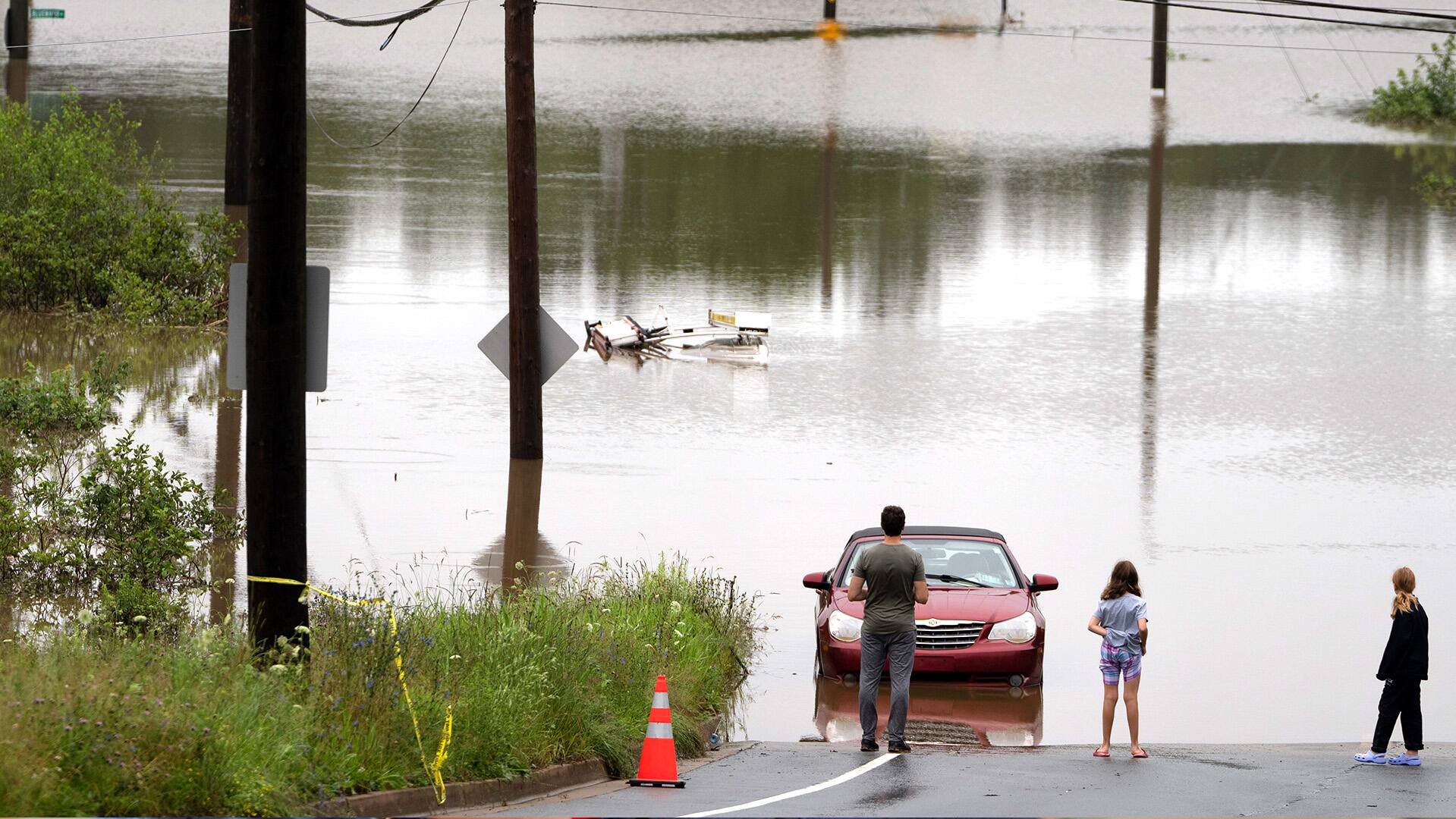
A potent rush-hour rainstorm swamped the New York metropolitan area on Friday, shutting down parts of the city's subway system, flooding streets and highways, and delaying flights into LaGuardia Airport.
Up to 13 centimetres of rain fell in some areas overnight, and as much as 18 centimetres more was expected throughout the day, New York Gov. Kathy Hochul said.
"This is a dangerous, life-threatening storm," Hochul said in an interview with TV station NY1. "Count on this for the next 20 hours."
Hochul declared a state of emergency for New York City, Long Island, and the Hudson Valley.

Traffic was at a standstill, with water above cars' tires, on a stretch of the FDR Drive — a major artery along the east side of Manhattan. Some drivers abandoned their vehicles.
Priscilla Fontallio said she had been stranded in her car, which was on a piece of the highway that wasn't flooded but wasn't moving, for three hours.
"Never seen anything like this in my life," she said.
Photos and video posted on social media showed water pouring into subway stations and basements.
Transit delays, cancellations
The Metropolitan Transportation Authority, which runs subway and commuter rail lines, urged residents of the nation's most populous city to stay home if they could. Virtually every subway line was at least partly suspended, rerouted or running with delays, and two of the Metro-North Railroad's three main lines were suspended.
Flights into LaGuardia were briefly halted, and then delayed, Friday morning because of water in the airport's refuelling area. Flooding also forced the closure of one of the airport's three terminals.
Towns and cities around New York City also experienced flooding, including Hoboken in bordering New Jersey.
The deluge came less than three months after a storm caused deadly floods in New York's Hudson Valley and left Vermont's capital, Montpelier, submerged. A little over two years ago, the remnants of Hurricane Ida dropped record-breaking rain on the Northeast and killed at least 13 people in New York City, most of whom were in flooded basement apartments. Overall, 50 people died from Virginia to Connecticut.

Hochul warned New Yorkers on Thursday of rainfall amounts on "a scale that we're not accustomed to dealing with," adding that New Yorkers "have to get used to this" because of climate change.
As the planet warms, storms are forming in a hotter atmosphere, making extreme rainfall more frequent, according to atmospheric scientists.


